The Mackay Port Authority is a statutory model Government Owned Corporation
(GOC) with two shareholders—
(1) the Treasurer of Queensland, and
(2) the Minister for Transport.
The current face value of the issued share capital is $139,208,804
(combined airport and seaport).
 |
The Authority owns (freehold) about 150 hectares at the Mackay Airport.
At the seaport, it controls about 800 hectares, most of which is
now freehold. It also holds leases over the seabed within the harbour
walls.
|
See the latest version of the Land Use Plan.
|
The Authority is not part of the Queensland Government but is merely
a wholly owned entity. It does not employ any public servants.
|
The Authority is not funded by Government. Apart from its early repayable
loans, it never has been funded by Government. Nor has it been funded
by ratepayers.
|
The Port Authority, under the recent Integrated Planning Act, is
now in effect the local authority for planning and building purposes
within its port lands. (Previously, it was exempt from Council
planning schemes but was required to seek Council building approval.)
All lands controlled by the port authority are port lands (airport
and seaport).
But the Council has certain responsibilities that do extend into
port lands; and in certain circumstances the Council levies rates
on some parts of those lands.
|
The segregation of small-craft operations from commercial shipping,
and the associated segregation of public traffic from heavy trucks
and trains within the port, were key strategies developed in the
1992 Port Development Plan.
As the Authority had no desire to own or manage a small-craft
harbour, it agreed with the shareholders that the ownership and
ongoing management of the marina would be offered to the private
sector. That open public offer, made in 1994/95/96, resulted in
the selection committee's recommendion to Cabinet that Port Binnli's
proposal be accepted. Cabinet adopted that recommendation. Port
Binnli Pty Ltd entered into contractual arrangements with the Mackay
Port Authority, and the MPA entered into similar arrangements with
the State Government to ensure that the project fulfilled all requirements.
The Port Authority owns the breakwater, the seabed within the
marina, and the public pedestrian esplanade along the waterfront.
The seabed and the esplanade are leased to Port Binnli, which is
required to keep the esplanade in good repair and maintain public
access.
Apart from the boat ramp carpark, which reverts to Queensland
Transport, the remainder of the land within the marina development
becomes freehold. When the developments reach the specified milestones,
the titles to the freehold parcels will pass from the State to
the MPA and then to Port Binnli.
|
Although about half of the port area used to be Reserve, in effect
all of our land will soon become freehold and thus be 'owned' by
the MPA. At the airport this process has been completed. It affects
about 150ha; at the seaport, the area will ultimately be nearly 800ha
|
Yes, but under slightly different legislation.
|
Its role is to ensure the ongoing operational status of both the
seaport and the airport, and to continue to meet users' needs. In
addition, the MPA must act at all times in the best interests of
the shareholders.
|
All positions offered at the MPA are keenly contested, clearly indicating
that the community regards the MPA as a leading regional organisation
that rewards its employees.
|
The harbour is dredged to a theoretical depth of 8.5m below low water
line. So there should never be less than 8.5m available to shipping
in the designated harbour areas. Because of the large tidal range
of up to 6.5m, navigable depths up to 15m are available to permit
the arrival and departure of deep-draught vessels.
|
The new northern access road will allow vehicular access to the northwall
beach without interfering with trucks carrying cargo from wharf #5.
But once the prill sulphur terminal becomes a reality, public access
will have to be denied from time to time in the interest of safety.
|
The port development plan recognised that the growing safety concerns
would necessitate increasing periods during which the northern wall
would have to be closed if the Authority is to meet its legal safety
obligations under Workplace Health and Safety (WH&S;) legislation.
So, to provide some offset to that growing restriction, and as part
of the new southern breakwater construction, the MPA has developed
the new road along the crest of that new wall and installed street
lighting to provide access at all hours to the full length of that
wall.
This commitment provides a fair balance. The public are able to fish
and observe the port operations safely without interfering with those
operations.
|
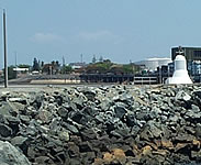
Yes. The design of the wall was modelled on the long-term stable
profile adopted for the original breakwater.
Although not readily observable in the new area, that profile is
a stepped outer slope. The excess material extracted to form the
new small-craft harbour entrance was placed on top of the wall as
extra reinforcement.
What was not apparent until that excavation took place was that the
material extracted from the original breakwater was extremely variable
in size and generally much smaller than the construction drawings
indicated. Some very large rocks, however, were encountered near
the base of the excavation.
As a result, heavy seas often move the overlying layer and either
throw it onto the road or erode it. But this process does not affect
the structural stability of the underlying wall.
|
Port Regulations have always banned fishing from the wharves, and
the northern wall is generally closed.
Traditionally, some leniency has been allowed when operational requirements
permit. No restrictions apply to the southern breakwater at any time.
|
No. The boat ramp is now to be used as a barge ramp. All small-craft
operations will be relocated to the new boat-launching facility in
the marina.
|
The short- and medium-term projections for the port do not indicate
any effect on the current north wall alignment.
The long-term projected needs, however, anticipate reclamation along
the beach to the north by about half a kilometre, enclosed by a new
north wall. The ultimate development would allow ships larger than
Panamax to berth at the projected outer harbour wharves; and container
shipping could be established.
As outlined in an earlier comment, at some future time WH&S; issues
associated with mixing public access with port operations will require
beach access to be relocated. The Authority is working with the Slade
Point Natural Resources Committee to develop future beach access
from the northern end of the Slade Point Industrial Estate.
This development would also serve as the southern access to the Reserve
and the northern access to proposed boardwalks through the Authority's
conservation areas, particularly the melaleuca forest. In short,
there will always be access to the beach, although the location of
that access may change over time.
|
The Authority has undertaken to conserve over 25 per cent
of its seaport land holdings permanently-substantially more than
any comparable port does. The remainder of its land will be considered
for development to meet demands. In addition, owing to the high
cost of raising much of the future port land to building level,
it will also seek to take economic advantage of opportunities to
use material dredged to deepen the harbour.
|
Significant areas west of Slade Point Road are included in the conservation
areas, but substantial areas are either of little environmental value
or have been degraded by past uses. These degraded areas will be
considered for development as previously mentioned.
|
When port needs unavoidably affect the environment, 'environmental
banking' is regarded as the optimal solution. Under that concept,
any significant habitat destruction would be compensated for either
by rehabilitating an agreed area of damaged land elsewhere (perhaps
not in the port area) or by creating a new, equivalent environment.
|
The quarry is considered an ongoing operational asset of the port.
Although originally the small-craft harbour project was expected
to use up the rock extracted from the quarry, it was subsequently
proved to be capable of providing for the small-craft harbour and
to have the potential to produce up to a further five million tonnes.
The Authority, therefore, will continue to retain the quarry licence
and will carefully manage the quarry and adjacent uses to allow its
future operation.
|
With the current relocation of the acid pipeline, no operational
requirement now justifies retaining the pier. The Authority is committed
to removing the pier during the next three years; the Board has clearly
directed that the demolition work begin as soon as possible.
Ian Meech is studying the best way to carry out the demolition.
|
The harbourmaster controls navigation within the port. The Port Authority
is responsible for providing and allocating facilities in the port.
The stevedores or terminal operators are responsible for loading
and unloading and for transporting products to and from terminals.
The only element of loading and unloading controlled by the Authority
is the wharf crane on wharf #5—a crane operated by stevedoring
personnel.
|
Passenger head tax is levied by many airports, but usually not at
major airports where other sources of revenue fund the operation
and maintenance of passenger terminals etc. For example, at international
airports, major revenues are derived from shopping (particularly
duty free), and from parking charges, which combine to obviate the
need for any passenger charge.
|
See earlier comments on the area west of Slade Point Road.
|
Sulphur is used for a wide range of products. The Mackay proposal
relates to the Marlborough Nickel Project, which involves a laterite
deposit about 20km south of Marlborough. The project has not yet
been approved and still has both economic and environmental hurdles
to overcome.
Recovering the nickel requires the production and consumption of
substantial quantities of sulphuric acid, and continual importing
of about one thousand tonnes of sulphur per day.
Prill sulphur is a specially produced form of sulphur that eliminates
the major handling difficulties. It comprises molten sulphur cooled
into pellets one to two millimetres in diameter. The result is a
uniform, almost odourless product, that is easy to handle, that will
flow easily through chutes and onto conveyors, and that does not
easily degrade. Dust problems are thus avoided.
|
Dust produced by inappropriate handling can dissolve in water and
become corrosive. The appropriate management practices, therefore,
are all intended to prevent the degradation of the prill sulphur.
|
There will be no sulphur plant at the port. We will merely have a
storage terminal (north of the grain terminal on the north frontage
of the new northern access road) that will receive sulphur by truck
from ships at wharf #5 and that will stockpile the material under
a roof until dispatch. For dispatch, the product will be fed onto
a conveyor leading to a rail loading facility next to the storage
terminal.
|
It will be stored within concrete walls on an AC-paved floor under
a ventilated roof.
|
Yes, it is safe provided appropriate handling standards are met.
As previously explained, it is essential to adopt processes that
avoid degrading the product from prill form into powder or dust.
|
No—see previous comments.
|
Public comments, an integral part of environmental assessments, must
be given due consideration by the approving agencies. At the end
of that process, if the project obtains all required approvals, it
would be expected to proceed.
|
No - it is unfortunate that political agendas have inflamed
public concerns to unjustified levels.
The normal Environmental Impact Study (EIS), begun in 1998, would
have addressed these issues in due course. But the timeframe for
completing that process is beyond the MPA’s control and has
been progressively extended owing to financing delays.
The Authority has responded to these community concerns by accelerating
its assessment of its requirements. The process entailed considerable
expense in undertaking a fact-finding inspection at Vancouver in
April 2001 to identify and understand the appropriate management
practices for avoiding environmental impacts.
|
The old JM Mulherin Memorial Park will be retained until 2005. By
that time it is expected that Mackay people will accept as a substitute
the new Mulherin Park, comprising stage 1 (completed in 2000) and
stage 2 (to be completed by MCC in 2001-02). So the Authority will
progressively review options for alternative uses of the old park
to complement the marina development and also to provide an appropriate
transition of land use to protect the fuel terminal operations along
Hamilton Drive.
|
See previous answer.
|
As the new park is the responsibility of Mackay City Council, that
agency will determine what facilities will be provided.
|
Mackay City Council owns the park. See previous comments on Stage
2 timing and facilities.
|
By arrangement between MCC and the Mackay Surf Life Saving Club,
the new park already incorporates public toilets at its northern
end. The planned stage 2 at the southern end will incorporate additional
toilet facilities.
|
The old JM Mulherin Park was funded directly by the Mackay Harbour
Board from its own funds, none of which came from ratepayers.
|
See previous comments on conservation areas. More than 25 per cent
of the land is permanently preserved for conservation.
|
All tenants are obligated by law and through standard lease clauses
to comply with all environmental standards. Many operations specifically
require environmental licences that require rigorous standards to
be maintained.
|
|